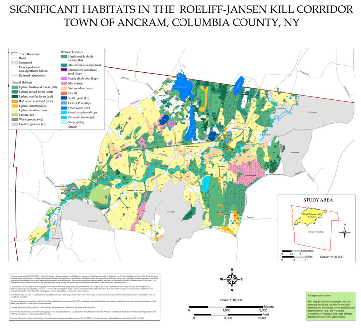
Working with Hudsonia and the Ancram Conservation Advisory Council, Jamie chairs this volunteer project to map the habitats for the 28,000 acre Town of Ancram. Through analysis of soils, topography, vegetation, geology, watersheds and aerial photos the team identifies habitats such as hardwood swamps, fens or cool hemlock ravines. Identification of habitats includes learning indicator species and the wildlife associated with each habitat. These maps will be used by the Ancram Planning Board and are posted for the public on the Ancram Town website.
CAC_Ancram_Biodiversity_Map (pdf)
Team Credits:
- Hudsonia Ltd. – http://hudsonia.org
- Town of Ancram, NY – Conservation Advisory Council (CAC) – http://townofancram.org/CAC